A series of three winter storms is hitting the Northeast this holiday week. The systems will bring snow, ice, and rain from Tuesday through Saturday. Travel is expected to be heavily impacted during one of the busiest weeks of the year.AccuWeather forecasts confirmed the timeline. The storms threaten to disrupt road and air travel for millions.
Three-Storm Timeline Targets Key Corridors
The first clipper moved through Tuesday. It dropped light but slippery snow on major interstates like I-80 and I-81.Boston saw one to three inches. Some areas in northern New England received up to six inches. Snow showers and gusty winds lingered into Wednesday morning.The second storm arrives on Christmas Eve. It may split, bringing snow to northern zones and rain farther south.A wintry mix of snow and ice is possible overnight into Christmas Day. This affects southern New York and central Pennsylvania.
Major Weekend Storm Raises Ice Threat
The third storm is the biggest concern. It arrives Friday and lasts into Saturday. This system will tap into colder Arctic air.AccuWeather expects three to six inches of snow from New York City to Connecticut. The Catskill Mountains could see over half a foot. Philadelphia and Washington D.C. will likely see a messy mix.Significant ice accumulation is forecast for some regions. Up to a quarter-inch of ice may glaze parts of Pennsylvania and West Virginia. This raises serious concerns for power outages.
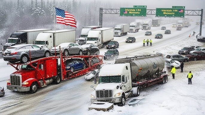
Travel Disruptions Loom for Millions
Major highways along the I-95 corridor face significant impacts. Airports in New York, Boston, and Washington may see delays. Deicing operations will slow everything down.Even modest snowfall causes major problems during peak travel. Post-Christmas weekend traffic will be severely affected. Officials urge people to check forecasts before leaving home.
Kate Hudson’s Debut Album Sparks Career Revival and Award-Winning Film Role
The back-to-back nature of these Northeast holiday week winter storms creates a compounding hazard. Residents and travelers should prepare for difficult conditions through Saturday.
Info at your fingertips
Q1: When will the worst travel conditions hit?
The most significant impacts are expected from the third storm, starting Friday. Post-Christmas weekend travel will likely be the most disrupted. Icy roads and flight delays are probable.
Q2: Which areas will get the most snow?
Areas north and west of major cities like New York will see the highest totals. The Catskill Mountains and northeastern Pennsylvania could get 6 to 12 inches from the weekend storm. Boston and parts of New England are also in line for several inches.
Q3: Is there a risk of power outages?
Yes, especially from the Friday-Saturday storm. Forecasts indicate potentially a quarter-inch of ice accumulation in parts of Pennsylvania, Michigan, and West Virginia. Ice is a major cause of power line damage and outages.
Q4: Are flights being canceled already?
Major airlines have issued travel advisories for the region. While widespread cancellations are not yet in effect, delays are highly likely as the storms progress. Passengers should check directly with their airline for the latest status.
Q5: What’s the difference between these clipper storms?
Clipper storms are fast-moving systems that typically bring lighter snow. The third storm is different. It is tracking farther south and will draw in more moisture, making it stronger and capable of heavier snow and ice.
Trusted Sources: AccuWeather, National Weather Service.
iNews covers the latest and most impactful stories across
entertainment,
business,
sports,
politics, and
technology,
from AI breakthroughs to major global developments. Stay updated with the trends shaping our world. For news tips, editorial feedback, or professional inquiries, please email us at
[email protected].
Get the latest news and Breaking News first by following us on
Google News,
Twitter,
Facebook,
Telegram
, and subscribe to our
YouTube channel.

