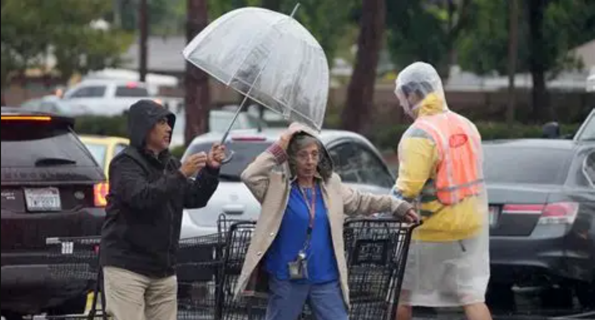
A powerful atmospheric river is currently drenching Southern California. This intense storm system arrived on Friday and is expected to last for days. The National Weather Service warns of significant risks, including dangerous rockslides and debris flows.

The greatest threat is to the Los Angeles areas recently scarred by wildfires. These denuded landscapes are highly vulnerable to flooding and mudslides. Evacuation orders are already in effect for these high-risk zones.
Atmospheric River Unleashes Widespread Hazards
More than four inches of rain has already fallen in coastal Santa Barbara County. The storm is now moving south toward the Los Angeles basin. Forecasters predict the heaviest rainfall will occur through Saturday night.
Damaging winds are also a major concern with this storm. The weather service has not ruled out the possibility of a tornado forming. Residents across the region are being urged to stay indoors for their safety.
The heaviest rain could dump as much as an inch per hour. This intensity will quickly overwhelm drainage systems. Widespread traffic incidents, delays, and road closures are anticipated.
Evacuations Ordered for Vulnerable Communities
Mandatory evacuation orders are in place for specific properties. These are in the Palisades and Eaton fire burn areas. Law enforcement is going door-to-door to ensure residents leave.
Evacuation warnings cover broader parts of Ventura County. These areas also include land burned by wildfires earlier this year. The orders are active from Friday evening through Sunday morning.
Canyon roads are at extreme risk for mudslides. Topanga Canyon is highlighted as particularly vulnerable. Neighborhoods below these scorched hillsides must remain on high alert.
The storm system initially hit the San Francisco Bay Area on Wednesday. It is a long plume of tropical moisture that formed over the Pacific. Southern California will see widespread rain through Sunday.
This relentless atmospheric river event underscores the growing volatility of West Coast weather patterns, with communities now facing a multi-day battle against flooding and landslides.
Info at your fingertips
What is an atmospheric river?
An atmospheric river is a long, narrow plume of concentrated moisture in the atmosphere. It acts like a river in the sky, transporting vast amounts of water vapor from the tropics. These systems are responsible for a significant portion of the West Coast’s precipitation.
Why are burn areas at higher risk for mudslides?
Wildfires burn away vegetation and roots that hold soil in place. The burned ground also becomes water-repellent, preventing absorption. When heavy rain falls, it easily washes the unstable soil downhill as destructive mudslides.
How much rain is Southern California expecting?
The storm is predicted to dump several inches of rain across the region. The most intense periods could see rainfall rates of up to one inch per hour. This will lead to significant flooding in urban and vulnerable areas.
Are tornadoes common in California during these storms?
While rare, tornadoes can occur. A tornado touched down in a Los Angeles suburb during a 2023 storm, causing damage. The unique dynamics of a strong atmospheric river can create conditions favorable for tornado formation.
How long is this storm expected to last?
The heaviest impacts are forecast from Friday through Saturday night. However, rain is expected to continue through Sunday. Another, weaker storm system is predicted to follow early next week.
iNews covers the latest and most impactful stories across
entertainment,
business,
sports,
politics, and
technology,
from AI breakthroughs to major global developments. Stay updated with the trends shaping our world. For news tips, editorial feedback, or professional inquiries, please email us at
[email protected].
Get the latest news and Breaking News first by following us on
Google News,
Twitter,
Facebook,
Telegram
, and subscribe to our
YouTube channel.


