A powerful winter storm that has already glazed highways and disrupted travel across the Midwest is forecast to rapidly strengthen into a bomb cyclone as it moves up the East Coast from late December 2, 2025. The system will bring heavy snow to interior parts of the Northeast and New England, while major cities along the I-95 corridor see mostly cold rain and gusty winds.
This is the third significant winter storm in a week, and it comes as colder Arctic air dives south and locks in behind the system. Forecasters warn that dangerous wind chills and potentially record-breaking low temperatures will spill east of the Rockies in the storm’s wake through late week.
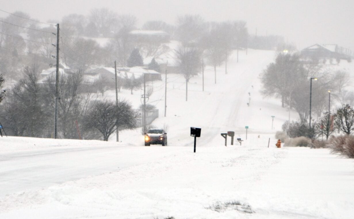
Winter Storm Spreads From Midwest To Northeast Before Bomb Cyclone Phase
The current winter storm first intensified over the central United States, dropping several inches of snow from Kansas and Missouri into Illinois and Iowa on December 1. In Kansas City, 3.6 inches of snow at the international airport set a new daily snowfall record for December 1, breaking a mark that had stood for four decades.
Chicago endured another round of snow on top of its record November event, with forecasters calling for 2 to 4 inches timed directly with the afternoon and evening commute. Over the weekend, Chicago O’Hare International Airport picked up more than 8 inches in a single day, the city’s snowiest November day on record, contributing to hundreds of flight cancellations and significant delays.
Farther south, freezing rain and sleet created treacherous conditions in parts of Arkansas and southeast Missouri. Police in St. Louis reported numerous crashes and urged residents to stay off the roads as snow quickly coated highways and local streets. Travel cameras showed vehicles stalled or stuck along major interstates as just 1 to 3 inches of snow caused gridlock.
As the storm shifts eastward, snow continues to expand across the Ohio Valley and into the interior Northeast overnight into Tuesday, December 2. The heaviest accumulations are expected away from the coast, especially across higher elevations of Pennsylvania, upstate New York, Vermont, New Hampshire and interior Maine.
Winter storm warnings and winter weather advisories now stretch more than 1,500 miles from the central Plains through the Great Lakes and into New England. Early-season snow cover is unusually extensive, with NOAA analysis showing about 33.4% of the Lower 48 states blanketed in snow on December 1, the highest for that date since 2019.
Why The Bomb Cyclone Will Spare Many Along I-95 From Heavy Snow
Forecast models show the system rapidly strengthening once it moves offshore near the Mid-Atlantic and New England coastline on Tuesday afternoon. Meteorologists expect the storm’s central pressure to drop roughly 27 to 29 millibars in 24 hours, meeting the criteria for bombogenesis and classifying it as a bomb cyclone.
Despite that intensification, cities along the I-95 corridor from Washington, DC, to Boston are likely to see mainly cold rain with only brief early-morning snow or a rain-snow mix. Warm, moist air flowing north from the Gulf of Mexico and relatively mild Atlantic Ocean waters will limit the ability of snow to accumulate in these dense urban corridors.
Forecasters point to the so-called “40/70 benchmark” – the point where 40 degrees north latitude meets 70 degrees west longitude in the Atlantic – as a key factor. When storms track directly across that spot in the presence of cold air, major snow events often strike the Northeast’s big cities. This storm is expected to track just west of that benchmark, drawing warmer marine air into the coast and tilting the balance toward rain instead of heavy snow along I-95.
Interior locations, especially in the hills and mountains away from the Atlantic influence, will stay colder. Those areas are set up for the storm’s highest snowfall totals, with localized amounts exceeding half a foot possible in parts of northern New England by early Wednesday.
New Jersey officials are already acting on these forecasts. Governor Phil Murphy has declared a state of emergency effective at 5:00 a.m. on Tuesday, December 2, for five northwestern counties – Hunterdon, Morris, Passaic, Sussex and Warren – where snow, sleet and freezing rain are expected to make travel hazardous.
Polar Vortex Shift Sets Up Brutal Cold Behind The Winter Storm
Behind the storm, a surge of Arctic air will flood south, causing temperatures to plunge well below early December averages from the northern Plains to the Great Lakes and into the Northeast. Meteorologists say daytime highs in parts of the Dakotas and upper Midwest could run 20 to 30 degrees below normal by Wednesday, December 3, as the coldest air spills in.
Overnight lows may drop into the teens below zero in portions of North Dakota, Minnesota and Iowa later in the week, with near-zero readings and subzero wind chills in surrounding states. In Chicago, actual temperatures could hover near zero by Friday morning, with wind chills dipping into the single digits below zero.
Scientists tie this stormy, volatile pattern in part to a recent disruption of the polar vortex, the band of strong winds high over the Arctic that typically helps keep the coldest air locked near the pole. When that circulation weakens and slides southward, frigid air can spill into the midlatitudes and collide with relatively warmer air masses, increasing the odds of strong winter storms and large temperature swings.
Researchers caution that the polar vortex disruption is not the only factor driving the current barrage of storms, but it is a key contributor to the cold and stormy pattern expected to persist through at least the first half of December. That means more episodes of “weather whiplash” are possible, with brief warm-ups followed by sharp returns to deep winter cold as additional systems track across the country.
For now, the focus remains on the current winter storm and its evolution into a powerful bomb cyclone along the East Coast. Residents from the Midwest to New England are urged to prepare for dangerous travel, rapidly changing conditions and a blast of severe cold once the storm passes, as this early-season winter storm sets the tone for what could be a very active December.
FYI (keeping you in the loop)-
Q1: What is a bomb cyclone in this winter storm?
A bomb cyclone is a storm that rapidly intensifies when its central pressure drops at least 24 millibars in 24 hours. In this case, forecast models show the coastal low deepening quickly off the Northeast, leading to stronger winds, rough seas and heavier precipitation for parts of New England.
Q2: Which areas are most likely to see heavy snow from this winter storm?
The highest snow totals are expected in interior parts of the Northeast and New England, especially across higher elevations of Pennsylvania, upstate New York, Vermont, New Hampshire and interior Maine. Coastal cities along I-95 from Washington, DC, to Boston should see mainly rain with limited snow accumulation.
Q3: How will this winter storm affect travel in the Midwest and Northeast?
In the Midwest, the storm has already produced slick highways and numerous crashes in cities like St. Louis and Kansas City, along with flight disruptions in Chicago. As the system moves east, hazardous driving conditions will develop across the interior Northeast, while low clouds, rain and gusty winds may cause new delays at major airports from Philadelphia to Boston.
Q4: Why is it turning so brutally cold after the winter storm?
Arctic air behind the storm is plunging southward, riding a displaced polar vortex and a wavy jet stream pattern. This allows very cold air to spill into the central and eastern United States, driving temperatures well below normal and pushing wind chills into dangerous territory for millions.
Q5: How unusual is the current early-season snow cover across the US?
NOAA snow analyses show that about one-third of the Lower 48 was snow covered on December 1, 2025, the highest for that date in several years. This widespread early-season snowpack, combined with repeated storms, signals a much more wintry start to December than many regions have seen recently.
References
CNN. 2025. Winter storm to morph into bomb cyclone as it hits the Northeast. December 1, 2025.
Associated Press. 2025. Heavy snow predicted for Northeast as Midwest still struggles with Thanksgiving weather snarls. December 1, 2025.
NOAA / NOHRSC. 2025. National Snow Analyses – Area Covered By Snow: 33.4% on December 1, 2025. December 1, 2025.
Office of Governor Phil Murphy. 2025. Governor Murphy declares State of Emergency for five counties ahead of winter storm. December 1, 2025.
Fox Weather. 2025. Arctic blast to chill more than 235 million as air from polar vortex surges across US in December deep freeze. November 29, 2025.
iNews covers the latest and most impactful stories across
entertainment,
business,
sports,
politics, and
technology,
from AI breakthroughs to major global developments. Stay updated with the trends shaping our world. For news tips, editorial feedback, or professional inquiries, please email us at
[email protected].
Get the latest news and Breaking News first by following us on
Google News,
Twitter,
Facebook,
Telegram
, and subscribe to our
YouTube channel.


